Exploring the Library: The Dillon Family Map and Geographic Information Center
November 8, 2019
A month ago, my mom and dad were visiting San Diego with my Uncle Bud. I drove down for the day to visit with them. The day before, my uncle gave me directions to get from Orange to a small visitor’s center that we were meeting at. He gave me step by step instructions to the location but did not give me the address because the visitor’s center had closed years ago and the address was removed. I kept asking for the address but he couldn’t give it to me.
The thought of only following my uncle’s directions without the use of my phone’s GPS terrified me and I knew that I was not going to be able to get there if I didn’t have the directions. I ended up finding the exit he told me to take before the visitor’s center on my phone and followed my GPS there. Once I got off the exit, I had no idea where to go. All I remembered was that the visitor’s center was on the left. I ended up going the wrong way and used my mom’s location on her phone to find their destination.
If it weren’t for the maps on my phone and the GPS that told me exactly where to go, I would have completely gotten lost. I have become so reliant on my phone’s GPS that I cannot even fathom having to get somewhere without it or worse, with only a paper map. The generation that I am growing up in has become extremely reliant on technology. I remember when I was younger, my parents would pull out large road maps during trips and use them to navigate. I am so far removed from that system of navigation that I rely solely on my phone.
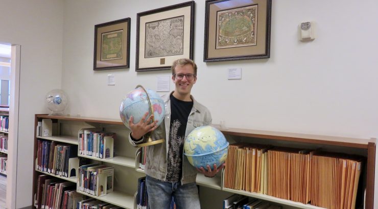
Phone GPS would be nothing if it weren’t for the cartographers who created maps for centuries before the telephone was invented. That is what the Dillon Family Map and Geographic Information Center (MAGIC) has taught me. This facet of the library is located in a little room on the second floor. Hung on the walls are numerous maps depicting all different styles. The different forms of maps show that all over the world, people have been using maps as a form of navigation for a very long time. From Dutch mapmakers to the Marshall Islands, maps have helped people travel all over the world. If you walk through this center, this is apparent.
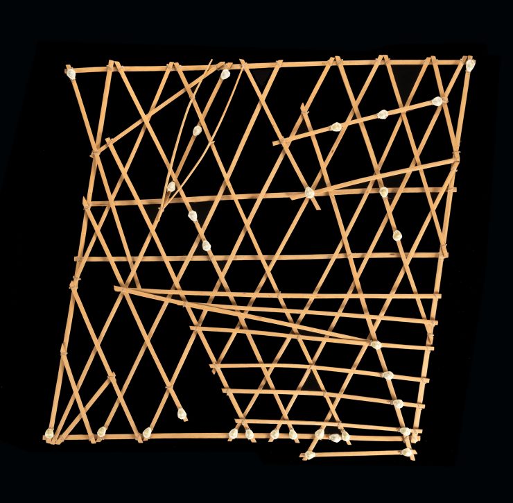
Marshall Islands Stick Chart
A map hung on the wall that I have never seen before was the Marshall Islands stick chart. This chart was made by the Marshallese to navigate around the Marshall Islands. The map shows the ocean swell patterns and how the island disrupts those patterns. These charts are made of coconut fronds and cowrie shells. The islands in these charts are represented by the shells or junctions of two or more sticks. These maps were memorized by the travelers and never consulted during trips. The Marshallese navigators used their memory and knowledge of underlying ocean swells to guide them. These stick charts were used by the Marshallese until after WWII when modern navigation became accessible to the islands.
Another incredible piece that I discovered while in the center was a gift of Ludie and David C. Henley, “The Terra Sancta.” This map is a leaf from Abraham Ortelius’ Theatrum Orbis Terrarum, printed between 1595 and 1612. The Theatrum Orbis Terrarum was the first atlas that presented a unified series of maps of the world. The maps within this book are ornamented with elaborate drawings that show a new style of cartography that Dutch mapmakers instituted. This elaborate ornamentation led to the Dutch people’s supremacy in map-making from 1570 to 1670.

The most modern of Ortelius’ maps of the Holy Land, which first appeared in Ortelius’ Theatrum Orbis Terrarum in 1584.
There is an incredible number of different maps throughout the world and throughout history. A lot of them are very different from the one I have on my phone. Map-making has always been an important part of humankind. They have helped us explore the world and expand our horizons. While I use maps today to drive places, maps have been more than just roads and landmarks, they have been an art and a way of remembering where we have been. The Dillon Family Map and Geographic Information Center displays a part of history that I often overlook and that is the history of the map. If you ever need a reminder of how our ancestors used to travel from place to place, check out this unique area in the library!