Co-seismic changes in water level observed in borehole located in China associated with Nepal Earthquake of 25 April 2015
September 15, 2016
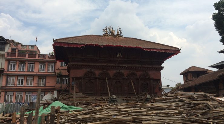
On 25 April 2015, a 7.8 magnitude occurred in Kathmandu, Nepal, this earthquake took life of 8,000 people and injured more than 21,000 people. Many historical, old and new buildings were damaged. The earthquake shaking triggered extensive landslides and also snow avalanches at high mountain peaks. The impact was also observed in India, Bhutan, China, Myanmar and Bangladesh. The Asian region is densely populated, home of one third of global population in Asian countries.
So far, scientists have not found any reliable indicator for an early warning of earthquakes, and some of the scientists based on many years of data do not believe they will find a reliable indicator which can be used to predict an earthquake. Despite this, countries like China are making efforts to monitor all kinds of land, subsurface, atmosphere, ionosphere related parameters on the surface and through boreholes all over China to get a reliable precursor of an earthquake. China is also planning to launch a satellite for earthquake monitoring.
Chinese Visiting scholar Anhua He worked one year during 2014-2015 with me, Ramesh Singh, Ph.D., Professor of Earth System Science and Remote Sensing, on our campus, utilizing water level and underground temperature data measured in wells. Changes in ground water level and water temperature in boreholes in and around earthquake epicenters have been studied for several decades. Water is a rigid body and is incompressible. Due to the expansion and contraction associated with the stress and the propagation of seismic waves, the water table is believed to fluctuate. If the borehole penetrates through a well-confined aquifer, the water level in the borehole fluctuates due to the internal pressure of the aquifer, known as the co-seismic response of water levels. During the stress build-up process, water in different layers is mixed; as a result the temperature may vary depending upon the water temperature in different layers. Changes in water temperature also depend on the subsurface geology. Co-seismic changes in water wells could be a possible indicator of changes in tectonic strain associated with earthquakes. The permeability of rock and strain could be a more plausible factor to explain observed co-seismic changes associated with earthquakes.
In China, various parameters are being monitored in water wells, including water level, water temperature and water radon concentrations associated with earthquakes. Recently, co-seismic changes in water level and water temperature associated with many earthquakes were observed. The study of co-seismic changes in groundwater has emerged as an important research area, which can provide an improved understanding of earthquake processes and corresponding changes in surface and subsurface parameters.
Our detailed analysis of water level and water temperature at the Jingle well located in Jingle County, Shanxi Province, China, (about 2769km from the epicenter of Nepal earthquake) show co-seismic change of water level up to a maximum variation of 1.75m associated with the 25 April 2015 Nepal (Mw7.8) earthquake. However, water temperature measured by a sensor deployed at the depth of 365m show no appreciable change. The results of the detailed study were recently published online in an international Journal (Tectonophysics, http://dx.doi.org/10.1016/j.tecto.2016.08.019).
The analysis of seismic phases in water level oscillations in the Jingle well associated with the Nepal earthquake. The P-, S- and surface waves were clearly identified as propagating through the water level. The borehole-aquifer system can amplify the ground vibration, and the amplification factor will be larger with the intense ground vibration. Potential precursory waves were recorded about 6.5 hrs prior to the Gorkha earthquake, similar waves were also recorded in the large Chilean earthquake of 22 May 1960 (magnitude 8) about 15 minutes prior to the earthquake, the mechanism is still not know. It may be that the changes in magnitude of water level could be also associated with the tidal forces depending upon the moon phases as it was observed recently by Japanese scientists in a recent paper published in Nature Geoscience (published online September 12, 2016, DOI: 10.1038/NGEO2796).
I have taken a lead to organize a session, ”Hydrological, Geochemical, and Geophysical Responses to Earthquakes” together with Michael Manga, University of Berkley and Chi-Yu King, Earthquake Prediction Research, Los Altos, CA during the Fall AGU meeting in San Francisco, during December 12-16, 2016. This session will be video recorded and there will be nine speakers and all interested can watch oral presentations.
Ramesh Singh, Ph.D., is Professor of Earth System Science and Remote Sensing at Chapman University’s Schmid College of Science and Technology (chapman.edu/science).